St John's & Parishes · Parham
Parham, the First Port, and St Peter’s Church
A morning-to-late-afternoon look at Parham, once the colony’s first port and main town, with its octagonal church and sheltered harbor.
- Parish
- St Peter
- From St John's
- 20 minutes
- Reading
- 4 min
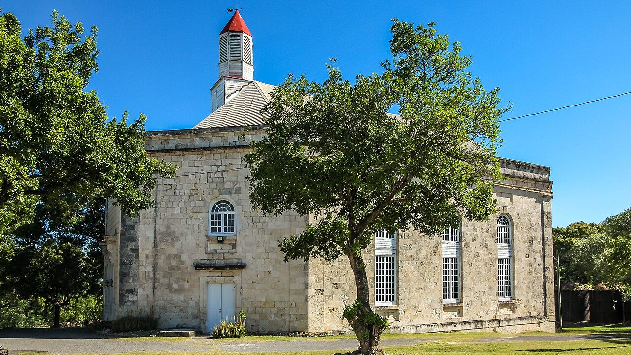
1843 is the year the earlier church at Parham was destroyed in an earthquake, and it’s a useful place to begin a morning here. What is Parham now? It’s a small town on Antigua’s north-east coast, in the parish of St Peter. What was it before St John’s grew? The first port and main town of the English colony on Antigua. Those facts set two versions of the place beside each other: a small town today, and a town that once carried the colony’s main port and town roles. The story doesn’t need a grand entrance. It starts with what remains, and with the harbor beyond.
Morning at St Peter’s Church
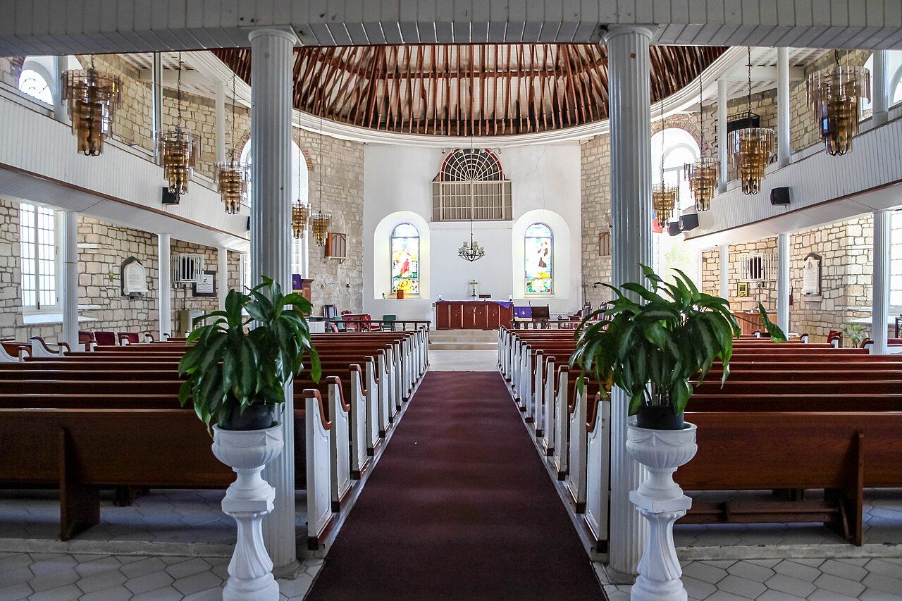
What should the morning’s first question be? St Peter’s Church is the obvious one. It’s an octagonal church in Parham, built in the 1840s and designed by the architect Thomas Weekes. The shape gives the eye something clear to hold onto; the date gives the church a place in the town’s longer story. There was an earlier church here, destroyed in the earthquake of 1843. That’s a plain sequence, but it changes the way the present church reads: not as the start of the story, but as the building that came after a loss.
St Peter’s Church is an octagonal church built in the 1840s, designed by Thomas Weekes.
St Peter’s Church is an octagonal church built in the 1840s, designed by Thomas Weekes.
What does the church tell us about Parham’s place in the colony? Not everything, of course, but it offers a point to begin asking. Parham was the first port and main town before St John’s grew; the church’s history sits within a town whose importance belongs to an earlier chapter. That’s the shape of the visit, too: a present-day small town, a church with a specific history, and a harbor that helps explain why Parham mattered. The account stays close to those pieces rather than trying to fill in what isn’t known.
When the sun stands overhead
What lies beyond the church? Parham Harbour, a sheltered inlet protected by islands and reefs. The harbor gives the town’s former role a physical setting: Parham was the colony’s first port, and sugar was shipped out through Parham during the plantation era. The water, islands, and reefs are part of the setting; the shipping is part of the history. Put them together and the port story becomes easier to picture, even if the town’s central place belongs to the past.
Is the harbor only a historical detail now? No: fishing boats still work out of Parham Harbour. That continuing activity belongs in the story alongside sugar shipping, not in place of it. The inlet is sheltered, and its position among islands and reefs is part of what defines it. For a visitor, midday can be the point to turn from the church toward the harbor and ask how a working waterway and an old colonial port fit together in the same small town. The facts don’t need to be made bigger than they are.
What else sits around the inlet? Crabbs Peninsula lies on the eastern side of Parham Harbour, while the North East Marine Management Area covers the waters and islands off the coast beyond Parham. Those names mark a wider maritime setting, extending the view beyond the town itself. The harbor isn’t the whole coastline, and the town’s story isn’t just the church or the port. There’s a distinction between the sheltered inlet and the waters and islands beyond it, and the afternoon can follow that distinction without turning it into a complicated itinerary.
Late afternoon
What fits into the late-afternoon part of the story? The old sugar estate nearby: Parham is a short drive from the old sugar estate nearby and from the airport. That puts the town in easy reach of two useful reference points, without needing to make either one the reason to come. Sugar belongs to Parham’s own history, too, since it was shipped out through the port during the plantation era. The connection is there in the facts, and it’s enough to link the harbor’s past with the landscape around the town.
So what is a visit to Parham, taken across the day? It’s a look at a small north-eastern town that was once the English colony’s first port and main town, before St John’s grew. It’s a church built after an earlier one was destroyed, and a sheltered harbor where fishing boats still work. History has moved the town out of its former position, but it hasn’t erased the places and details that explain that position. There’s no need to force a grand ending onto it; the harbor’s story is still open, and the town’s sits beside it.
The numbers: St Peter’s Church was built in the 1840s; the earlier church was destroyed in 1843.
What becomes of a first port when the harbor still has work to do?
Photo credits: Dr. Thomas Liptak: Creative Commons BY 4.0; Dr. Thomas Liptak: Creative Commons BY 4.0; CROIX: Creative Commons BY-SA 4.0.


