St John's & Parishes · Bolans
Jolly Harbour, Bolans and the Villages of St Mary
A south-west road itinerary from Jolly Harbour’s canals to Bolans and Old Road, with fishing villages, pineapple country and the Shekerley Mountains along the way.
- Parish
- St Mary
- From St John's
- 25 minutes
- Reading
- 3 min
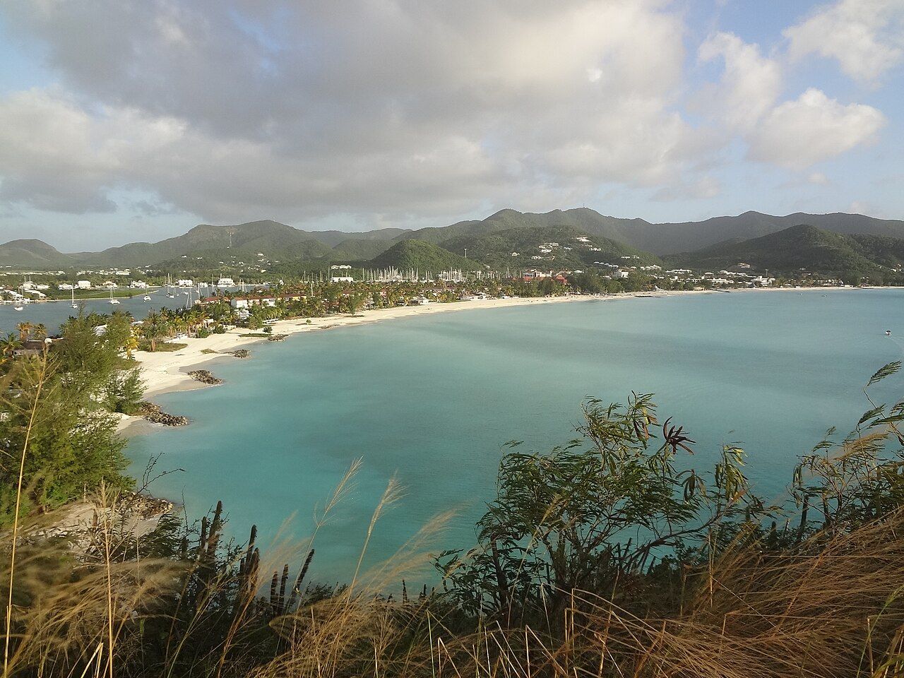
There’s a small map puzzle in St Mary: how do canals, villages and a coast road fit into the same south-west corner? The answer comes into focus as the day moves along the road. Jolly Harbour is a marina and residential community built around canals; Bolans is just inland; Old Road and other villages carry the route toward the coast and north to St John’s.
Morning around Jolly Harbour
What’s the first stop? Jolly Harbour, on Antigua’s west coast, where the marina community was built around a network of canals in the 1990s. The canals give this part of the route its shape, while the place itself has both a marina and a residential community. It’s a useful beginning for a parish that isn’t only coast or only village: the south-west road links the villages of St Mary with St John’s to the north.
And where does Bolans fit? Just inland from Jolly Harbour, in the parish of St Mary. That’s a short description, but it changes the feel of the map: the canals belong to one kind of settlement, Bolans to another, and the road ties them together. St Mary covers the south-west corner of Antigua, so the itinerary isn’t a single waterfront stop. It’s a route through a parish, with its villages set between the coast and the Shekerley Mountains rising behind them.
Midday on the south-west road
What’s on the road between Bolans and St John’s? Jennings sits on the main road between the two. It’s a handy name to keep in mind when following the route north or south, though the south-west road’s larger story is how it links St Mary’s villages with St John’s to the north. The map’s not asking for a complicated plan here (a road, a village, then the next place); it’s asking for a little attention to how the settlements sit in relation to one another.
And where does the coast come back into the picture? Urlings is a fishing village on the south-west coast between Johnson’s Point and Old Road. Urlings gives the fishing villages of the south-west a place in this connected stretch, rather than leaving them as isolated names on a map. the fishing villages of the south-west Cades Bay is also on the south-west coast, known for pineapple growing. Here the route’s story shifts from canals and village links to fishing and growing, without leaving the same corner of the island.
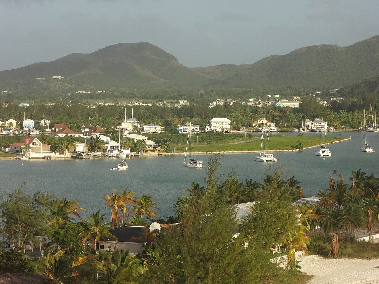
What’s the landscape behind those villages? The Shekerley Mountains rise behind them. It’s a simple detail, but it gives the route another line to follow: coast in front, mountains behind, villages in between. St Mary’s map is starting to read less like a list of stops and more like a set of relationships.
Late afternoon at Old Road
Why carry on to Old Road? It’s a village on the south-west coast, where the English are said to have landed in 1632. The wording matters: they’re said to have landed there. That association gives the village a place in the parish’s history, while its position on the coast keeps it part of the route through St Mary today. Bolans, Urlings, Jennings and Old Road aren’t interchangeable names; each marks a different point in the parish’s pattern.
So what does a day’s route leave behind? Jolly Harbour’s canals, Bolans just inland, Jennings on the main road, Urlings on the coast, Cades Bay’s pineapple growing and the Shekerley Mountains behind the villages. Old Road brings the route back to the coast, then the south-west road points north toward St John’s. There’s also the wider island story to carry along:
The numbers: 25 minutes from St John’s. The canals do the winding; the road gets the punchline.
Photo credits: lisa bat: Creative Commons BY 2.0; lisa bat: Creative Commons BY 2.0.

